A powerful Nor’easter storm has prompted a state of emergency for nine million residents along the US East Coast, as officials prepare for potentially dangerous conditions. Nor’easters are storms named for their typical winds blowing from the northeast, and they commonly affect the coastline with strong winds, rain, snow, and flooding. Though they can occur any time of year, they are most intense between September and April.
This storm is expected to grow stronger as it moves northward, with coastal winds ranging from 40 to 60 mph and gusts possibly reaching up to 80 mph—hurricane force according to the Saffir-Simpson scale. Every county in New Jersey is now under emergency orders as the storm approaches, with Acting Governor Tahesha Way urging residents to remain cautious, monitor weather updates, and stay off roads unless absolutely necessary.

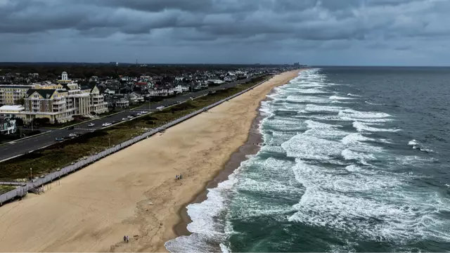
The National Weather Service forecasts that the combination of strong onshore winds, high surf, and high tides will bring major coastal flooding, especially in Delaware, southern New Jersey, and the Virginia Tidewater area. Residents along the coastline are advised to heed local officials’ warnings and evacuation orders.
The storm is expected to worsen on Monday before gradually weakening and moving out to sea by Tuesday. High winds raise concerns about power outages and fallen trees, while the broad storm swath threatens cities from North Carolina up to New York City, including Boston and Philadelphia. Air travel disruptions are already anticipated in the region.